CONTOUR MODELING THAILAND WITH R2V
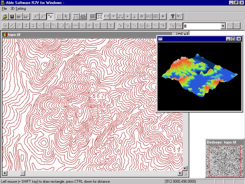
The Environmental Information Center (EIC), an arm of Thailand's Environment Institute, is currently making daily, production-run use of R2V for Windows (32-bit version) on seven workstations. "We're primarily using Able Software's R2V for Windows to automate data capture of contours from black-and-white photo separates of 1:50,000 scale topographic maps," says Mr. Paul Hastings, EIC Director.
EIC obtains their raw data from the Royal Thai Survey Department, charged with base map production in the Kingdom. These contour layers are used to construct digital elevation models in Arc/Info for use in several projects including watershed definition, mining zonation, terrain visualization, and pollution control.
In the past, EIC would take about 10 days to manually digitize and edit a dense contour map. R2V for Windows has cut this task down to about 2 days -- a 5-to-1 speed improvement! Furthermore, EIC found that the final database products using R2V for Windows are of much higher fidelity than those which were produced manually.
Mr. Hastings said that they (EIC) had prior experience with Hitachi's CadCore Tracer package, and that it just couldn't measure up to R2V for Windows for ease of use, applicability to GIS and mapping, speed, and price (where CadCore Tracer is easily 2 to 3 times more expensive than R2V for Windows and infinitely more difficult to use). According to Mr. Hastings, "Hitachi (CadCore Tracer) is 90% CAD and only 10% mapping, and that 10% is terribly inefficient with its line-by-line vectorization (no batch vectorization, i.e., line extraction), poor design, and slow throughput ... their contour package has basically the same faults.
Another data automation task that EIC is applying R2V for Windows to is the capture of urban scale (1:4,000) city maps for a pollution control project covering 25 provinces in Central Thailand. They found R2V for Windows to be very useful in capturing and identifying line work from these maps for final input into an Arc/Info database.
Overall EIC is quite pleased with R2V for Windows in its present form as well as the future direction the product seems to be taking. "The responsiveness of Able Software to user requests for additional functionality is a refreshing change from the normal take-it-or-leave-it attitude of many software vendors," enthused Mr. Hastings, "This gives EIC the confidence to continue to expand its production base of R2V for Windows applications as well as try to find new ways to make this software aid in the rather dreary task of data automation (still the largest part of any GIS work here in Thailand)."
About TEI and Mr. Paul Hastings: Mr. Paul Hastings is Director of the Environmental Information Center, a branch of the Thailand Environmental Institute (TEI). TEI makes use of the latest information technologies, such as Geographic Information Systems (GIS), and Global Positioning Systems (GPS) to service the Institute's information and analysis needs. Over 45 percent of the Kingdom's land area is currently covered in the Center's GIS database and contains data concerning climate, soil, geology, rivers, surface water, terrain, transportation, land use, political boundaries, demographics, economic status, and health infrastructure. For more information, please send email to Mr. Paul Hastings at the following addresses: paul@tei.or.th , their URL is: http://www.tei.or.th.